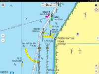
NET-173 Rotterdamse Hoek Creil (Rotterdam corner Creil)
Town Creil
Location Creil dike
Position Lat (dms) 52°45’52” N
Position Long (dms) 5°35’46” E
QTH-locator JO22TS
Year built 1950
Material Stone
Height construction (m) 7,5 m
Height light (m) 13 m
Range light (mi) 5-8 nm
Characterisic Deactivated 2001
Additional information:
The name of the (general guide) light refers to the materials used to construct the dike: debris from the 1940 bombardment of Rotterdam.
Last updated: August 2020