NET-AAE Makkum lights
Town Makkum
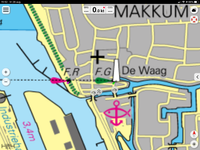
Location Makkum harbour entrance
Position Lat (dms) 52°03’18”N
Position Long (dms) 4°24’03” E
QTH-locator JO23QB
Year built -
Material -
Height construction (m) -
Height light (m) -
Range light (mi) -
Characterisic -
Additional information:
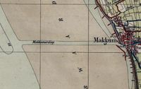
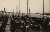
There is little information on Makkum, except that the town had a fishing fleet and a long, narrow and straight harbour entry with sand banks left and right. The narrow entrance is still visible today. It makes sense that this town had visible aids for navigation in the past.
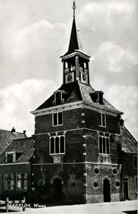
Today a approx. 4 m wooden pole with a light marks the low front at the waterfront. The light works in combination with a rear high lantern mounted atop a building further back in town (locally also known as De Waag, 1698). Light range unknown, but the approach line works in combination with red and green non-illuminated buoys.
Last updated: August 2020