NET-AAP Marken harbour
Town Marken harbour
Location Marken harbour
Position Lat (dms) 52°27’30” N
Position Long (dms) 5°05’57” E
QTH-locator JO22NL
Year built -
Material -
Height construction (m) -
Height light (m) -
Range light (mi) -
Characterisic -
Additional information:
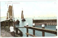
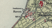
Marken Island (today peninsula) has NET-017 Paard van Marken, but in the past the town had a fishing community too. At least since 1910 the harbour has a light on the southern pier head. At first just a less than 2 m wooden pole with an almost domestic looking lantern. By 1960, both pier heads have lights, red and green. The location of the lights on these pier heads have never changed. At the end of the 1990s a third white light was added at the waterfront as an approach assistant. The former fishing fleet of Marken can be recognized by MK as vessel registration.
Last updated: August 2020


